Summer SAVY 2022/Session 2 – Dynamic Coasts for Rising 3rd/4th Grade
Friday: Today was a blast! We started out the day by learning about some of the animals that live in coastal environments like corals, oysters, and sharks. If you’d like, you can see if your student can tell you anything about why oysters are important for our coasts or if they can explain what happens with coral reef bleaching. We then learned some strategies for reading a scientific article and read a paper about how some coastal animals have learned to make homes out of coastal engineering structures like breakwaters. In the study, scientists drilled holes into breakwaters to create artificial rock pools to see if this would help algae and organisms live on engineered coasts. The paper they read can be found here (https://www.sciencejournalforkids.org/articles/could-this-be-a-concrete-solution-to-biodiversity-loss/) and is modified from a real journal article to be kid-friendly.
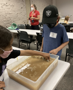
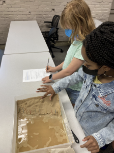
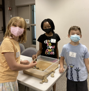
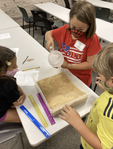
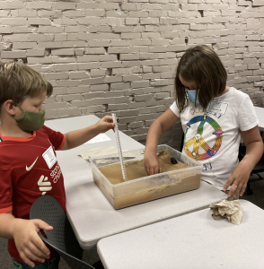
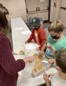
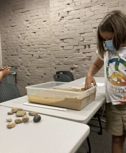
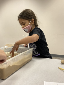
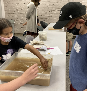
Next, we had to synthesize lots of the information we learned this week. Each group of students was given a coastal location to research using google earth and the NOAA sea level rise viewer. After determining if their location was at risk to sea level rise, students had to make a plan to engineer their coast using breakwaters, groins, seawalls, sea dikes, or beach nourishment. But here’s the catch – they only had a limited budget. They worked with their group, much like engineers, ecologists, economists, and geologists work together in real life, to make a management plan for their coastal town. Once they completed their proposal, they put their plan to the test! They were able to build or nourish their beach in the coastal wave tanks to see how they helped slow erosion of sediment from waves and protect their beaches!
Some questions you could ask your students are:
-
What type of coastal system was your city (i.e. beach, barrier island)?
-
Does your city have a big population and lots of buildings? How might this be important for coastal management?
-
Is your region vulnerable to sea level rise? At what amount of sea level rise would your city experience flooding?
-
What beach management strategy did your city choose and why? How does this strategy work?
-
What are some of the pros and cons of the beach management strategies you had to pick from?
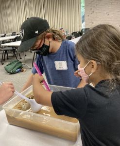
In the afternoon, we learned about oil spills. We did an activity to try and clean up an oil spill in our ocean tanks using certain clean-up materials (cotton balls, string, straws, tissues) with a limited budget for each spill cleanup. This allows students to see how dangerous oil spills can be and how difficult and expensive it is to clean up oil spills when they occur. We learned about sand mining from river deltas and coastal regions around the world and talked a bit about the global sand crisis!
Some questions you could ask your students about our oil spill activity are:
-
What are some of the things that you learned about oil spills?
-
What tools did you use to try and clean up the oil spills?
-
Which tools didn’t work to clean up the oil spill? Which tools worked best to clean up the oil?
This week was a blast and your students learned so much about our dynamic coasts. Thank you for sharing your bright students with us!
Thursday: In the morning we learned about climate change. We were able to connect what we learned to our sea level rise lab activities. We also used the NOAA sea level rise viewer (https://coast.noaa.gov/slr/) to look at predicted scenarios for future sea level rise under anticipated climate change scenarios.
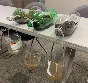
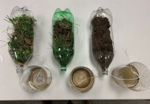
In the afternoon, we learned about how coastal scientists and engineers modify the coast to protect shorelines and the people that live there from rising sea level, waves, and storms. We learned about the different types of engineering structures, the pros and cons of each, and how to identify them. We also did an experiment to understand how engineering structures help limit erosion! We learned that vegetation and rocks protect sediment from erosion. Then we ended the day by taking a walk around the quad to find examples of erosion and weathering in our surroundings. We’re looking forward to tomorrow when we’ll be learning more about coastal pollution, sand mining, and the organisms that live on and near our coasts.
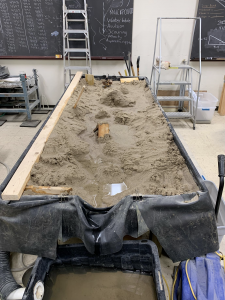
Wednesday: What a busy and fun day! We ran experiments using a stream table in a research lab in Vanderbilt’s Earth and Environmental Sciences Department. This activity helped us better understand how rivers erode and deposit sediment. We made meandering river channels and also observed how sediment movement in rivers changes depending on how much water is in the river. This complemented our exploration into river deltas like the Ganges-Brahmaputra delta in Bangladesh and the Mississippi river delta. We learned why New Orleans is sinking and the risks facing the Mississippi river delta and the people who live there. If you’d like to explore the Mississippi river delta, check out this website (https://projects.propublica.org/louisiana/#). Your students spent some time reading through the stories, so they should be able to tell you about what’s happening in Louisiana. Lastly, we learned about how scientists take sediment cores to study coastal systems. We took our own cores through layers of playdoh to visualize how scientists figure out what the sediments look like beneath our feet. Tomorrow will be another fun day filled with experiments and activities for your coastal scientists!
Tuesday: Today, we dove deeper into the processes that influence coasts and drive coastal change. We learned about erosion and weathering, waves, currents, and sea level rise. We even did some experiments to explore how waves move sediment along the coast and how melting land and sea ice contribute to sea level rise. We used the scientific method to make predictions about what we expect to happen in our experiments, created data tables to record the experiment, and made graphs to explore the results over time! At the end of the day, students learned about coastal hazards like storms, oil spills, and ocean acidification.
If your child is looking to continue exploring how climate change is affecting the earth, this NASA website (https://climatekids.nasa.gov/health-report-sea-level/) has learning modules and games related to changes in temperature, sea level, sea ice, and the atmosphere. We’ll learn even more about climate change and sea level rise tomorrow! We also explored Google Timelapse (https://earthengine.google.com/timelapse/), which shows how places around the world have changed over time. If you’d like to visit a place in Google Timelapse that we looked at in class, see if your student can explain how waves and currents are moving sediment at Fishing Point, Assateague Island.
We’ll be visiting a research lab in the Earth and Environmental Science department on Vanderbilt’s campus in the morning! Please be sure your child wears closed-toed shoes and long pants so we can go into the lab. They may also want to bring their SAVY umbrella for some sun protection and shade on the walk across campus.
Monday: We had a great first day in Dynamic Coasts! We started the day by familiarizing ourselves with Google Earth, a tool that geoscientists often use in their research! We learned how to describe our location using latitude and longitude and used Google Earth to explore the different coastal systems we’ll be learning about this week. We found examples of beaches, barrier islands, lagoons, saltmarshes, mangroves, and river deltas! We focused on understanding systems, their components, and how they change. We used this to frame our understanding of coastal environments like beaches as a system with inputs, outputs, elements, boundaries, and interactions.
We covered a lot of material today and created a foundation for all of the exciting labs and activities we have planned for the rest of this week! All of this will help students think critically about coastal ecosystems and change.
If you’re looking to explore the coast with your student, see if they can show you one example of a river delta, barrier island, or lagoon in Google Earth and explain how it forms. You could also ask them to explain some of the different parts of a beach system (inputs, outputs, etc.). If you do not have the desktop Google Earth application, the web version has similar capabilities and can be accessed via https://earth.google.com/web/.
We are looking forward to exploring coastal systems and processes the rest of the week!
